MONITORING METHODS COMPARED
Managing the right risk with the right technology
Effective geomonitoring relies on selecting the right combination of technologies.
Different methods provide different types of insight, and the most robust monitoring strategies are shaped by site conditions, risk profile and decision requirements.
Geomonitoring Technologies at a Glance
Different technologies provide different types of insight. Understanding their strengths helps define the right monitoring stack.
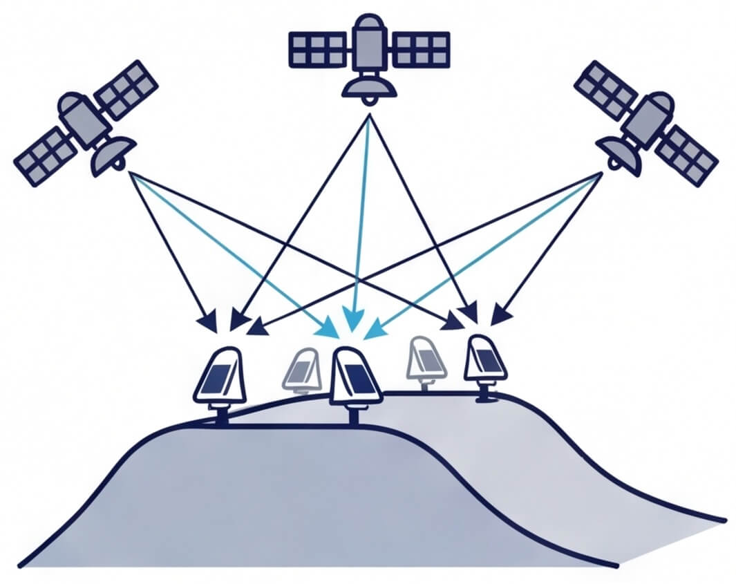
GNSS
Continuous, absolute 3D positional monitoring across large or distributed areas.
Requires sky visibility and GNSS interference mitigation expertise
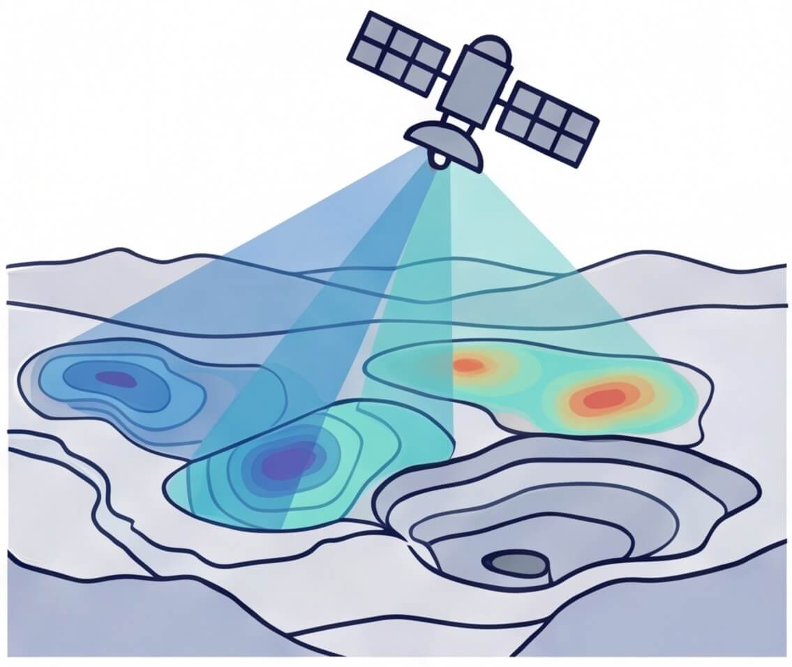
InSar (Satellite)
Wide-area deformation monitoring and retrospective movement analysis.
Satellite revisit dependent results limited to a line-of-sight direction

LiDAR
High-resolution surface modelling and change detection over time.
Periodic capture and lesser accuracy than alternative methods

Total Stations (Optical)
High-precision relative displacement monitoring with established line-of-sight.
Requires line-of-sight & expert survey maintenance
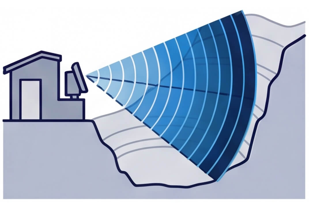
Ground-based Radar
Real-time detection of surface movement over targeted high-risk zones.
Line-of-sight, environmental fluctuations & higher unit cost

In-situ Instruments
Localised subsurface or structural measurements (e.g., tilt, pore pressure).
Localised, limited to range of motion and non-recoverable if damaged
Why GNSS in Monitoring
GNSS plays a critical role in many monitoring programs by providing continuous, true 3D positional measurement without line-of-sight constraints.
- No line-of-sight required
- Continuous, all-weather operation
- Scales across large or distributed sites
- Direct 3D positional measurement
While GNSS provides a powerful foundation, reliable monitoring depends on network design, signal quality and rigorous processing.
Kurloo GNSS Geomonitoring
Kurloo applies GNSS within a managed monitoring system designed specifically for reliability, validation and defensibility.
- Managed data validation
- Purpose-built resilient hardware
- Expert network design
- Powerful software to deliver insights
How Monitoring Approaches Differ
Different technologies provide different types of insight. Understanding their strengths helps define the right monitoring stack.
| Monitoring Characteristic | Kurloo GNSS Monitoring | Optical / Total Station | InSAR | Sub-surface In-situ Instrumentation |
|---|---|---|---|---|
|
Measurement reference |
Absolute (global reference frame) |
Relative |
Relative (LOS-based) |
Relative / local |
|
Displacement type |
True 3D vector displacement |
3D (line-of-sight dependent) |
Primarily vertical / LOS |
Direction dependent |
|
Monitoring frequency |
Continuous |
Periodic/Continuous |
Periodic (satellite pass) |
Continuous |
|
Line-of-sight required |
No |
Yes |
No |
No |
|
Coverage scale |
High — distributed & large-area |
Moderate |
Very high |
Localised |
|
Environmental sensitivity |
Low |
Moderate–High (visibility/weather) |
Moderate (decorrelation, atmosphere) |
Low |
|
Data continuity |
Designed for continuity |
Interruptions possible |
Satellite revisit dependent |
Susceptible to damage/loss |
|
Trend detection capability |
Excellent for long-term trends |
Good |
Good for broad-area trends |
Good (point-specific) |
|
Integration with other datasets |
Strong (GIS, InSAR, geospatial) |
Moderate |
Strong |
Moderate |
|
Infrastructure requirements |
Low field infrastructure |
Requires inter-visibility, power & comms |
None on site |
Borehole installation dependent |
Technical Specification Comparison
We’ve compared detailed performance metrics and specifications for Kurloo and other monitoring technologies.
Where Kurloo GNSS Excels
Kurloo GNSS monitoring performs complex analysis in a way that is quick, simple, and easy to understand.
It is particularly well suited to projects requiring reliable, continuous and defensible positional data.
Building an Integrated Monitoring Strategy
Complex or high-risk environments achieve reliable outcomes by combining technologies rather than aiming for a single technological approach.
Kurloo GNSS Geomonitoring as a backbone
Continuous 3D GNSS measurements at key points provide an absolute reference for interpreting radar, LiDAR, and InSAR displacement trends. This stable point of truth strengthens confidence when integrating multiple data sources. GNSS monitoring may be complemented where dense spatial coverage, subsurface measurement or short-baseline optical precision is required.
Examples of combined geomonitoring methods
- Tailings storage facilities: GNSS on embankments + InSAR + in-situ instruments
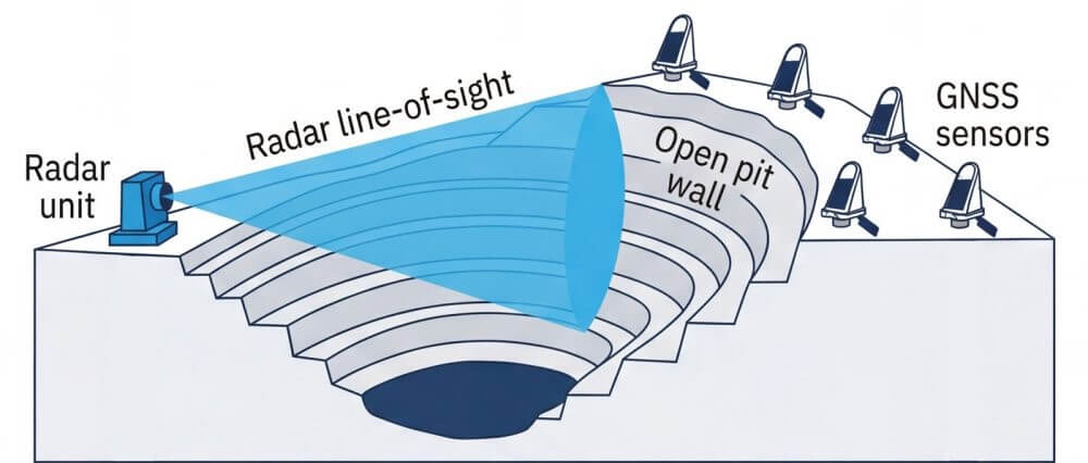
- Open pits: GNSS or ATS + radar + drone/LiDAR
- Landslides and slopes: GNSS or ATS + InSAR + subsurface instruments
The optimal mix depends on site geometry, failure mechanisms, and required response times.