About Kurloo
Not all monitoring captures the full mechanics of motion. Kurloo delivers GNSS-based geomonitoring that converts field measurements into continuous 6D Movement Intelligence.
Our Australian-designed monitoring system helps engineers, surveyors, and asset owners separate true ground movement from noise and local variables sooner, so they can act based on improved measurement evidence, not assumptions.
From mining and civil infrastructure to ports, dams and large assets, Kurloo provides a trusted source of truth for ground and structural movement in environments where safety, compliance, and operational continuity are critical.
Our Story
Kurloo was created to address a persistent challenge in geotechnical monitoring: establishing a reliable point of truth for how the ground is actually moving.
For decades, engineers relied on a combination of manual surveys, complex instrumentation, and periodic inspections to understand how the ground was behaving. These methods were often labour-intensive, expensive, and too infrequent to detect subtle movement early.
The result was limited visibility of millimetre-scale displacement — precisely the type of movement that can indicate emerging risk.
Drawing on more than 25 years of geospatial and monitoring experience, the founding team believed the industry needed a more scalable and affordable way to provide a trusted point of truth across monitoring programs. They developed a new model for geomonitoring:
- autonomous GNSS-IoT field devices
- cloud-based geodetic processing
- a managed monitoring service designed for real-world sites
The result is a monitoring system that delivers continuous, high-precision movement intelligence, without requiring specialist GNSS expertise on site.
Today, Kurloo provides a highly scalable source of truth for ground stability monitoring across mining, civil, and geospatial applications.
Our Vision
To empower more people in more places with trusted ground movement intelligence so they can act earlier to prevent failure and loss.
Our Mission
To make trusted ground movement intelligence accessible to more organisations, more often.
In a world where monitoring technologies are increasingly complex, Kurloo provides a reliable GNSS layer within the broader monitoring ecosystem, complementing technologies such as radar, InSAR, and conventional geotechnical instrumentation.
The Kurloo Approach
Kurloo does not simply supply monitoring hardware.
Our system combines field devices, geodetic processing, and expert oversight into a managed monitoring service that delivers reliable, 6D movement intelligence that stands up to scrutiny.
This approach allows clients to:
- detect subtle ground movement earlier
- reduce reliance on labour-intensive surveys
- maintain consistent monitoring over long project lifecycles
- provide transparent, defensible evidence for stakeholders
A Multidisciplinary Team
Kurloo brings together specialists across geospatial science, engineering, and software development.
Our team includes:
- geodetic data scientists
- machine learning and software engineers
- electrical and embedded systems engineers
- geotechnical and field monitoring specialists
Together, they design and operate the systems that transform raw satellite signals into validated displacement intelligence used by engineers and asset owners worldwide.
Proudly Australian-Designed and Manufactured
Kurloo is designed, engineered, and manufactured in Australia and proven in some of the harshest environments.
Our monitoring devices are produced in Brisbane in partnership with advanced electronics manufacturer IntelliDesign, allowing us to maintain tight quality control and continuously refine hardware performance.
Kurloo data processing and cloud services are hosted on Australian infrastructure, giving clients confidence that their monitoring data remains secure and governed by Australian law.
Industry Recognition
Kurloo’s monitoring technology has been recognised through major industry awards for both design and geospatial innovation.

Australian Good Design Award
Recognising excellence in product design, innovation, and real-world impact.
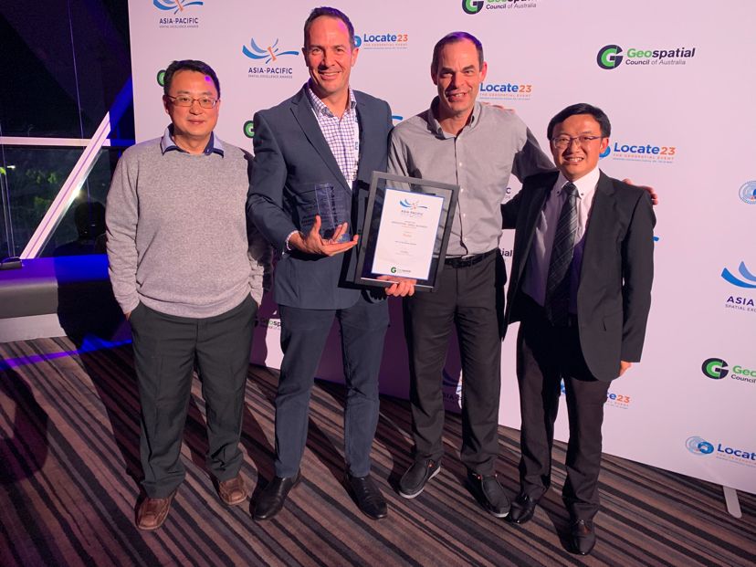
Geospatial Excellence Award for Innovation (National + Oceanic)
Presented by the Geospatial Council of Australia, recognising Kurloo’s contribution to advancing GNSS-based monitoring.
These awards reflect the integrated design of the Kurloo system — combining 6D measurement hardware, managed data integrity services, and clear movement intelligence software into a best-in-class GNSS monitoring system.
Explore how Kurloo combines field devices, managed data integrity, and the Kurloo Nest platform to deliver defensible movement intelligence.